

Pai
Pai is where backpackers make friends, in a valley loop of paddies, waterfalls and hot springs that beats any single sight. Yoga and detox at one end of town, a bar street at the other.
Pai in a nutshell
Pai: what to expect
What follows sits on 56,000+ stops planned in the town on Stippl.
Pai is a valley town a few hours north of Chiang Mai, and the riding is as much the point as the sights are. The loop through the paddies, waterfalls and villages is what people name first, above Pai Canyon at sunset or the 353 steps up to the White Buddha at Wat Phra That Mae Yen. Around those sit the hot springs at Tha Pai and Sai Ngam, the bamboo bridge at Boon Ko Ku So and the river cave at Tham Lod. Most travellers give the town 3 nights on Stippl.
People who plan Pai are on a different kind of trip, and the length of it gives them away. A trip that includes Pai runs 44 days on Stippl, against about three weeks for a Thailand trip generally, and 94.3% of them carry Chiang Mai as well. The minivan from Chiang Mai is the only way in, since the airstrip at Pai has no scheduled flights.
Two or three days covers the sights, and the valley loop is what you actually stay for. Ride it on a scooter if you already can, because there is no public transport here and no Grab either. Sunrise at Yun Lai above the Yunnanese village at Santichon, sunset at Pai Canyon, and Tham Lod as a full day out towards Mae Hong Son. Come between November and January, when the valley is cool, dry and clean, and stay away from February to mid-April, because Pai measures worse than Chiang Mai in burning season.
Plan Pai in Stippl
Day-by-day planning, stays and budget in one app, with every place from this guide already on the map.
Download the appWho Pai is for
Backpackers and social solos
A dense hostel scene with nightly events; making friends is the product, and most people give it 3 nights.
Riders and scenic-drive people
The valley loop and the Mae Hong Son Loop anchor the stay, and the surrounding landscape is the destination.
Wellness and yoga people
Yoga, breathwork, massage and a raw-vegan café cluster that is unusual for a town this size.
Party travellers
A bar street disproportionate to the town, live music, and tubing pre-parties on the river.
Couples and slow travellers
Paddy-view bungalows and cafés that are destinations in themselves sit on the outskirts, away from the strip.
Families
The Canyon corridor outside town gives space away from the backpacker scene, and that is where families do best here.
Maybe not for you: anyone travelling February to mid-April, when Pai's air is measurably among the worst in Thailand; anyone unwilling or unable to ride, because the sights are outside town with no public transport and no Grab; first-time riders; beach people; and anyone hoping for an undiscovered town.
The best time to visit Pai
Cool and dry
November to January
The season Pai is planned around: warm days, cold mornings, clean air, and the Thai domestic crowd at weekends. Also the price peak.
Burning season
February to mid April
Smoke settles into the bowl-shaped valley and reads higher here than in Chiang Mai in every month of it, worst in March. It overlaps the hot season.
Rainy
May to October
Green paddies, strong waterfalls and the cheapest rooms; tubing gives way to white-water rafting and the bamboo footbridges can be out.
- The valley traps smoke, so Pai reads a third to a half higher than Chiang Mai in every burning-season month. The guides that call February and March the best months are describing the weather and ignoring the air; the window is November to January.
- January is the month most travellers plan Pai for on Stippl, and it is planned only 65 days ahead. 19.9% of Pai plans are made inside a fortnight, the highest share in Thailand, which fits a town people decide on from Chiang Mai.
- Thai weekends and public holidays in the cool season fill the town. The domestic crowd arrives on Friday and the rooms tighten; a midweek arrival gets the valley to itself.
- December and January mornings run nine to fifteen degrees, and most budget bungalows are unheated. Bring the layer, and expect the cold to be the thing you remember about the canyon at dawn.
Add your Pai dates and we'll flag the weather
Stippl shows the season, crowds and prices for every stop on your route.
Describe your trip, get a Pai itinerary in seconds
Everything in this guide is already in Stippl. Tell the planner how long you have and what you like: it builds the route, the days and the travel times, and you edit whatever you want.
Things to do in Pai
Pai Canyon at sunset
Walk the narrow eroded ridges above the valley eight kilometres south of town, the town's signature image, free and with free parking. Go an hour before sunset and wear shoes with grip; the ridges are a metre wide in places.
The valley loop by scooter
Ride the loop of paddies, waterfalls, viewpoints and villages in a day, the best thing in Pai above any single sight. A scooter costs about €4 a day; the road is easy except the last climbs to the viewpoints.
The hot springs
Tha Pai, eight kilometres south-east, has developed pools inside Huai Nam Dang National Park, so the park fee of about €8 applies. Sai Ngam, thirty minutes north, is a single jungle pool at bath temperature for about €1 and the one locals use.
The bamboo bridge at Boon Ko Ku So
Walk the eight-hundred-metre bamboo bridge across the paddies, built so the monks could shorten their walk between village and temple. Brightest green in October and November, and the monks cross it on alms rounds at dawn.
The White Buddha
Climb the 353 steps of Wat Phra That Mae Yen, visible from everywhere in town, for the valley view. Shoulders and knees covered, shoes off at the top and sarongs rented at the bottom; free.
Tubing the Pai River
Float back to town in one to two hours in the dry season, about €5 with the tube and the lift upstream. In the rainy season the river runs too high and white-water rafting, about €35, is the substitute.
The neighbourhoods of Pai
The town centre
Walking street, night market
The walkable core: the night market from late afternoon, the bars, the minivan offices and the 7-Elevens. For first visits and anyone without a scooter; it is also where the smoke settles in burning season.
Everything on foot, and the noise of the walking street until late.
The east bank
Across the footbridge, cheaper
Minutes from the centre across the river by footbridge, cheaper for the same proximity and quieter at night. For budget travellers who want the town without sleeping on the strip.
Town prices halved, and a footbridge that floods in the rains.
Across the paddies
Bungalows below the Buddha
Rice-paddy bungalow country below the White Buddha hill, reached over bamboo footbridges that are a long detour when one is down. For couples and long stays who want the view from the hammock.
The paddies from the terrace, and a bridge that goes with the rainy season.
North Pai
Quiet resorts, waterfall road
Quieter resorts along the road to Mo Paeng waterfall and Sai Ngam hot spring. For families and riders who want the countryside and do not need the walking street outside.
The waterfall and the hot spring nearby, and a scooter for the town.
South Pai
Canyon, hot spring, resorts
Eight kilometres along Route 1095: Pai Canyon, Tha Pai hot spring, the Land Split and the Memorial Bridge, with resorts along the road and no backpacker scene. For families and for the sights on the doorstep.
The canyon and the hot spring at the door, and a ride into town for everything else.
See every Pai neighbourhood on one map
Save the areas you like and Stippl plots your days so you're not crossing the city twice.
Where to stay in Pai
Stay in the town centre for a first visit, or on the east bank across the footbridge for the same walk at a lower price; everything further out needs a scooter. Most people give Pai 3 nights on Stippl. Book ahead for December and January and for Thai holiday weekends, when rates double or triple around New Year; the rest of the year rewards turning up.
The town centre
Hostels with nightly events and free town shuttles, dorms €5 to €10, and small hotels €20 to €50.
The east bank
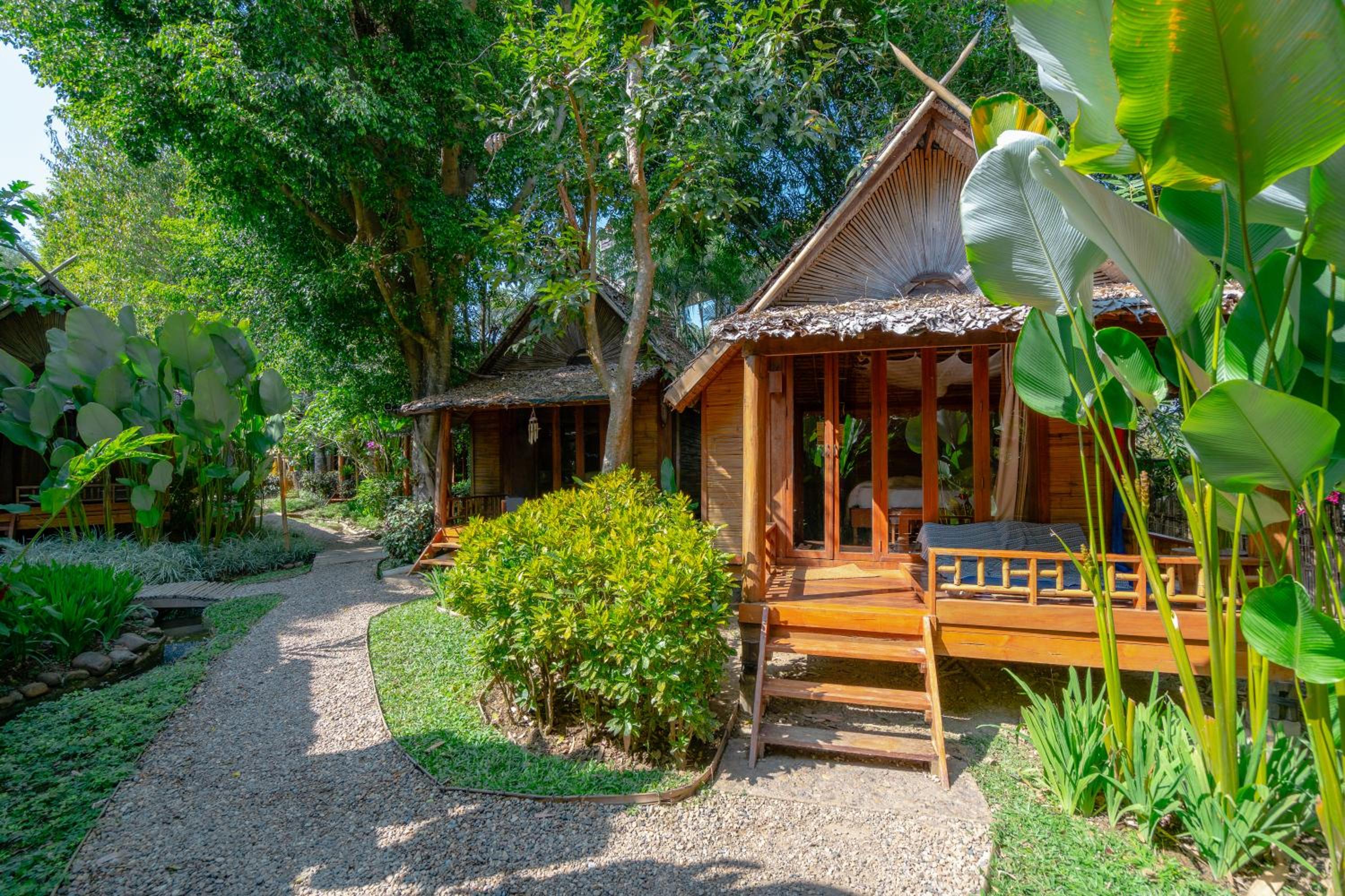
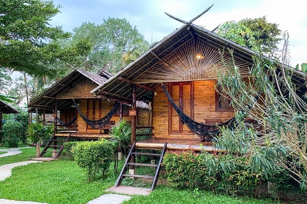
Bamboo bungalows with hammock balconies and family guesthouses, €10 to €30, across the river.
Across the paddies
Wooden bungalows and luxury paddy resorts, €25 to €120, reached over a bamboo footbridge.
North Pai
Quieter resorts with pools and long-stay cabins along the waterfall road, €30 to €90.
South Pai
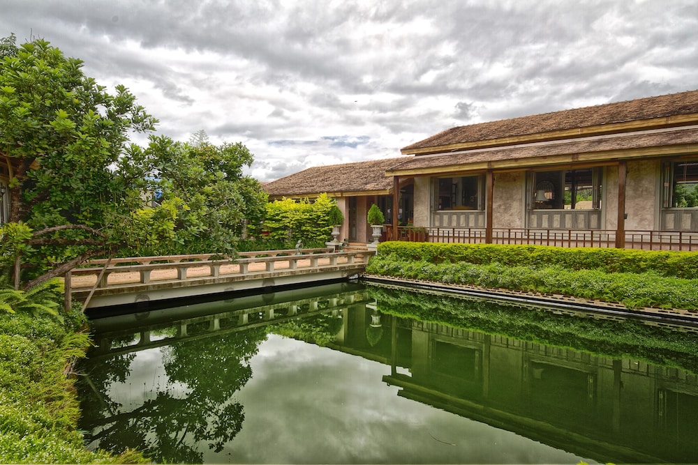
Roadside resorts near the canyon and the hot springs, €30 to €100, with no hostels at all.


What to eat in Pai
the northern coconut curry noodle soup
the Chinese-Yunnanese repertoire of the border villages
sticky mango rice, noodles, spring rolls, grilled everything
the paddy-side café signature
Discover food spots in Stippl
Find restaurants and markets on the map, save them to your itinerary, works offline too.
Pai customs and what not to do
Alms rounds pass at dawn
Monks collect door to door in the early morning near the bamboo bridge; giving is merit-making and watching quietly from the side is fine.
The hill heritage is real
Sai Ngam hot spring is managed with the local Karen community and Santichon is a Yunnanese village founded by families who crossed the border after 1949; both are homes first.
The White Buddha enforces dress
Shoulders and knees covered and shoes off, with sarongs rented at the foot of the steps; the climb is 353 steps and best before the heat.
The elephant camps are out
The camps on the Pai river fail the no-contact test and riding is against the national guidance; the long-neck tours sold in town are the staged version.
The drug reputation is stale
Cannabis now needs a Thai prescription and mushrooms were never legal; the bars still trade on the old image and the police still act on the current law.
Do
- Book the minivan out of Pai a day or more ahead; departures sell out
- Offer a photocopy plus cash deposit at scooter shops, never the passport itself
- Check a live air index before booking anything between February and April
- Carry a warm layer from November to February; mornings run 9 to 15 degrees
Don't
- Learn to ride a motorcycle here; most injured foreign riders at Pai hospital were first-timers
- Ride the 1095 at night, or after buckets
- Book the long-neck village tour or the riverside elephant camps
- Plan around Walking Street on a weekday; outside the cool season it only runs Fridays and Saturdays
What a Pai trip costs
Budget
€9.50–32
Dorm or hammock bed, night-market food, scooter, free or tens-of-baht sights.
Mid-range
€28–80
Private bungalow, café breakfasts, a tour or rafting day.
High-end
€80–125
Resort with paddy view, private driver days, onsen passes.
Track what you actually spend
Set a daily budget per country and log expenses in any currency while you travel.
Fun facts about Pai
The 762 bends to Chiang Mai are a t-shirt number, not an official count. The slogan has been on Pai's market stalls since 2012, and nobody has traced it to the highways department.
The Land Split is a farm that cracked open. The ground shifted, the crops went, and the family turned the fissure into a donation-based fruit and rosella stop.
Tham Lod cave held Stone Age teak coffins. The chamber still has the log coffins and wall paintings, and fills with a huge flock of swifts at dusk.
The Memorial Bridge was a Japanese invasion route. Built in the Second World War for the push into Burma, burnt afterwards and rebuilt because the villages needed it.
Pai Airport handled 9,979 passengers in 2009 and now handles none. That was the year Thai tourists discovered the town; today everyone comes in by the road.
About 222,000 foreign tourists visited Pai district in 2024. The town itself has about 2,300 residents, so that is roughly 96 visitors per resident before counting the Thai weekend crowd.
Local tips for Pai
The road is the only way in
Pai's airport has had no scheduled flights for years. It is 135 kilometres and three to four hours from Chiang Mai on Route 1095, with 762 bends, by minivan for about €7.
Book the minivan a day ahead
Two operators run from Chiang Mai's Arcade terminal, hourly from morning to mid afternoon, and every departure sells out in high season. Take a morning one; the road at night has killed people.
The bends make people sick
Motion sickness on the 1095 is a planning factor, not a joke. Sit at the front, skip breakfast, and take the slower bus if you know you suffer.
Nothing in Pai has a bus
The centre is walkable and everything worth seeing is outside it, with no public transport and no Grab. A scooter is the default, about €5 a day; a tuk-tuk for the day is the alternative.
Do not learn to ride here
Pai's hospital logs more than a thousand motorcycle injuries a year, most of them first rides. If you rent, the licence class on your IDP is what makes the insurance pay, not the shop's paperwork.
How long to stay
Most people give Pai 3 nights on Stippl, the lowest one-night share in Thailand. It is a town people settle into; the canyon, the loop and the springs each take a day.
Pai questions, answered
After Chiang Mai and before you turn back south, because the minivan from Chiang Mai is the only way in and the same road takes you out again. Lay the northern stops out in Stippl and count the road hours rather than the kilometres. Then ask people who have ridden the loop, in subreddits like r/ThailandTourism.
Fewer than a fifth of routes think so: 17.7% of Thailand trips planned on Stippl carry a Pai stop, which makes it a deliberate detour rather than a place you pass through. What the minivan buys is a valley of paddies, hot springs and viewpoints with almost no through traffic in it.
Winding enough that travel sickness is the standard complaint rather than danger. It runs a hundred and thirty-five kilometres from Chiang Mai and takes three to four hours by minivan, on continuous bends through the hills. Sit near the front, take something for it before you leave, and skip the big breakfast.
You will want to, because there is no public transport and no Grab, and the valley loop is rated above every single sight in the town. Ride only if you already can, and only on a licence that carries a motorcycle entitlement, because the climbs out of the valley are steeper than the map makes them look.
February to the middle of April. That is burning season across the north and Pai measures worse than Chiang Mai for it, because the smoke settles into a valley ringed by mountains. 61.2% of travellers who plan Pai on Stippl arrive between November and February, which is the window that works.
Less than they do for anywhere else in the north: travellers leave 65 days between planning a Pai stop on Stippl and arriving. That matches how people get here, which is deciding in Chiang Mai a few days out, and it is also why cool-season beds in town can be gone by then.
Every guide is written by the Stippl editors and checked against the trips our travellers actually plan. Spotted something out of date? Let us know.

Plan Pai in Stippl
Day-by-day planning, stays and budget in one app, with every place from this guide already on the map.
Download the app