

Ninh Binh
Ninh Binh est du karst que vous remontez en bateau, sur une rivière entre les rizières et sous les voûtes des grottes, sans croisière et sans mer. Cinq cents marches jusqu'à la grotte Mua offrent une vue sur toute la vallée inondée, et la boucle cycliste se fait à plat en une journée.
Ninh Binh en bref
Ninh Binh : à quoi s'attendre
Une vallée karstique à 90 km au sud de Hanoï, régulièrement appelée "Halong Bay sur terre", et géologiquement la même formation calcaire. Les rivières coupent à travers les tours plutôt que la mer, donc les bateaux passent sous les falaises au lieu de les contourner
Hoa Lư a été la capitale du Vietnam de 968 à 1010, sous les dynasties Đinh et Lê précoce, avant que Lý Thái Tổ ne déplace la cour vers ce qui est maintenant Hanoï. Les montagnes en étaient la raison : elles forment un mur défensif naturel autour de la vallée
Le 1er juillet 2025, les provinces de Hà Nam et Nam Định ont fusionné avec Ninh Bình dans le cadre de la réforme nationale qui a réduit les provinces de 63 à 34. Contrairement à Hội An, qui a perdu sa province au profit de Đà Nẵng, Ninh Bình a conservé son nom et gagné du territoire : la nouvelle unité couvre 3 942,6 km²
Planifiez Ninh Binh dans Stippl
Planification jour par jour, hébergements et budget dans une seule application, avec chaque lieu de ce guide déjà sur la carte.
Télécharger l'applicationÀ qui Ninh Binh s'adresse
Toute personne voulant du karst, pas de bateau
Ninh Binh est le paysage de Ha Long sans la croisière, et il figure sur 46,7 % des voyages au Vietnam sur Stippl pour exactement cette raison.
Cyclistes
Des routes plates et tranquilles entre chaque site, et la journée suggérée est une seule boucle.
Voyageurs d'histoire
Une capitale qui a duré 42 ans et a laissé des temples reconstruits sur leurs fondations d'origine.
Photographes
Les deux fenêtres de récolte et le point de vue de Mua Cave sont les cadres qui méritent d'être chronométrés.
Voyageurs à petit budget
Les maisons d'hôtes et les pensions sont bon marché même selon les normes vietnamiennes, et la plupart des gens y consacrent 2 nuits.
Peut-être pas fait pour vous : toute personne voulant de la vie nocturne, puisque la vallée ferme tôt ; et toute personne qui n'aime pas les escaliers ou la chaleur, car Mua Cave compte environ 500 marches sans ombre.
Le meilleur moment pour visiter Ninh Binh
Sec et gris
novembre à février
Peu de pluie, climat doux et progressivement gris. Novembre et décembre sont la période idéale ; janvier et février sont secs mais nuageux.
Vert et qui se réchauffe
mars et avril
Rizières plantées, températures confortables et humidité croissante.
Récolte et chaleur
mai et juin
La période dorée, avec plus de trente degrés et la pluie qui s'intensifie.
Humide, puis une deuxième récolte
juillet à début novembre
Les mois les plus humides jusqu'en septembre, puis à nouveau la période dorée en octobre à mesure que la pluie faiblit.
- Les rizières sont dorées deux fois, de fin mai à juin et de fin septembre à octobre, et vertes entre les deux. Le bateau à travers Tam Coc offre une image différente à chaque saison ; choisissez la moisson si la photographie est votre objectif.
- Janvier est le mois pour lequel les voyageurs planifient Ninh Binh sur Stippl, environ 63 jours à l'avance, et c'est un mois gris sur l'eau. 22,3 % des plans sont faits en moins de quinze jours, ce qui convient à une excursion d'une journée depuis Hanoi.
- Le Tet fin janvier ou février remplit les quais avec des visiteurs vietnamiens. Le tourisme domestique atteint son pic pendant la semaine ; allez un matin en semaine en dehors de cette période et les rameurs seront à vous.
- Le festival Truong Yen tombe le dixième jour du troisième mois lunaire, à l'ancienne capitale de Hoa Lu. Processions et jeux traditionnels ; la date change avec le calendrier, généralement en avril.
Ajoutez vos dates pour Ninh Binh et nous vous signalerons la météo
Stippl indique la saison, l'affluence et les prix pour chaque étape de votre itinéraire.
Décrivez votre voyage et obtenez un itinéraire pour Ninh Binh en quelques secondes
Tout ce guide est déjà dans Stippl. Dites au planificateur combien de temps vous avez et ce que vous aimez : il construit l'itinéraire, les journées et les temps de trajet, et vous modifiez ce que vous voulez.
Choses à faire à Ninh Binh
Un bateau à travers les grottes
Choisissez l'une de ces deux options : Tam Coc vous propose une balade sur la rivière Ngo Dong à travers les rizières et trois tunnels de grottes, propulsée à la rame avec les pieds ; Trang An offre un parcours plus long, davantage de grottes et de temples. Comptez entre 6 € et 10 € par bateau, et Trang An en début de matinée est l'option la plus tranquille.
Grotte Mua en fin de journée
Montez environ cinq cents marches jusqu'à l'éperon calcaire jusqu'à la statue du dragon et la vue sur toute la vallée inondée, environ 4 €. Vingt à quarante minutes de montée, et la dernière heure de lumière est celle où vous devez être.
Hoa Lu, l'ancienne capitale
Visitez les temples Dinh et Le, reconstruits au dix-septième siècle sur des fondations du dixième siècle et entourés par le mur de karst qui a rendu le site défendable. Environ 1 €, et un trajet à vélo plat depuis Tam Coc.
La boucle de la vallée en vélo
Faites du vélo vers Bich Dong, grotte Mua, Trang An et Hoa Lu en une journée plate, la raison de rester deux nuits plutôt que de faire une excursion d'une journée depuis Hanoi. Les vélos sont gratuits dans la plupart des séjours chez l'habitant ; partez à huit heures.
Pagode Bich Dong
Montez les trois niveaux construits dans une falaise au-dessus d'un lac de lotus, accessibles par un pont de pierre : 120 marches jusqu'au niveau de la grotte et quarante de plus vers le sommet. Gratuit, et le lotus est en fleur en juin.
Réserve naturelle de Van Long
Prenez un bateau à rames dans la plus grande zone humide de la région, un site de réhabilitation pour le langur de Delacour en danger, pour environ 1 € d'entrée et 3 € par bateau. Presque pas de visiteurs, et les langurs sont sur les falaises en fin d'après-midi.
Les quartiers de Ninh Binh
Tam Coc
Village touristique, karst derrière
Le village à l'embarcadère de la rivière Ngo Dong : maisons d'hôtes, séjours chez l'habitant, une rangée de restaurants et location de vélos, avec les tours de karst directement derrière et les marches de la grotte Mua accessibles à pied. Pour les premiers séjours et ceux sans transport.
Le bateau, la grotte et la promenade à pied, et le coin le plus fréquenté de la vallée.
Trang An side
Rizières, résorts bungalows
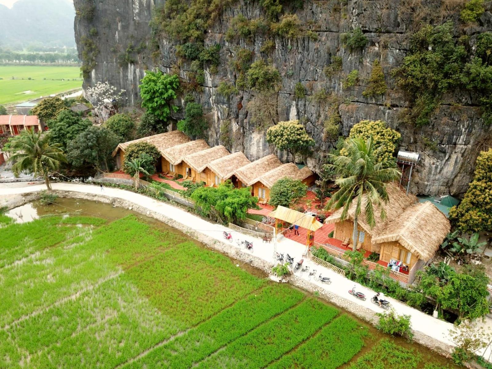
Au nord-ouest de la ville autour des embarcadères UNESCO et de l'ancienne capitale à Hoa Lu : nouveaux résorts bungalows et séjours chez l'habitant parmi les rizières, plus calme que Tam Coc. Pour les couples et familles qui veulent les champs depuis la terrasse.
Rizières au petit-déjeuner et calme, et un vélo ou un taxi pour chaque repas dehors.
Ninh Binh town
Gares, chambres les moins chères
La ville provinciale sur la rivière Day : la gare ferroviaire, la gare routière, l'hôpital et les chambres les moins chères, rien de pittoresque mais tout est connecté. Pour les arrivées tardives et les premiers trains.
Les trains et le prix, et dix kilomètres jusqu'aux paysages.
Cuc Phuong edge
Forêt, centre primatologique, lodges
La route vers le parc national de Cuc Phuong : quelques lodges et séjours chez l'habitant près de la forêt et du centre de sauvetage des primates, une heure des bateaux. Pour les randonneurs et pour une deuxième nuit loin de la vallée.
La forêt et le calme, et une heure pour accéder à tout le reste.
Découvrez chaque quartier de Ninh Binh sur une seule carte
Enregistrez les quartiers que vous aimez et Stippl organise vos journées pour éviter de traverser la ville deux fois.
Où loger à Ninh Binh
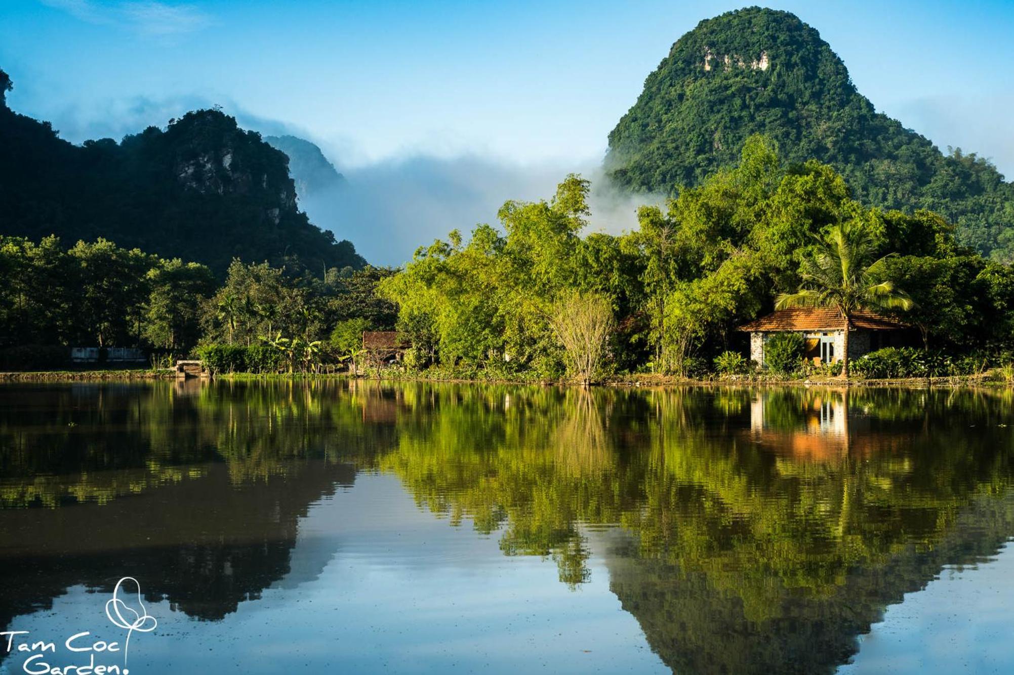
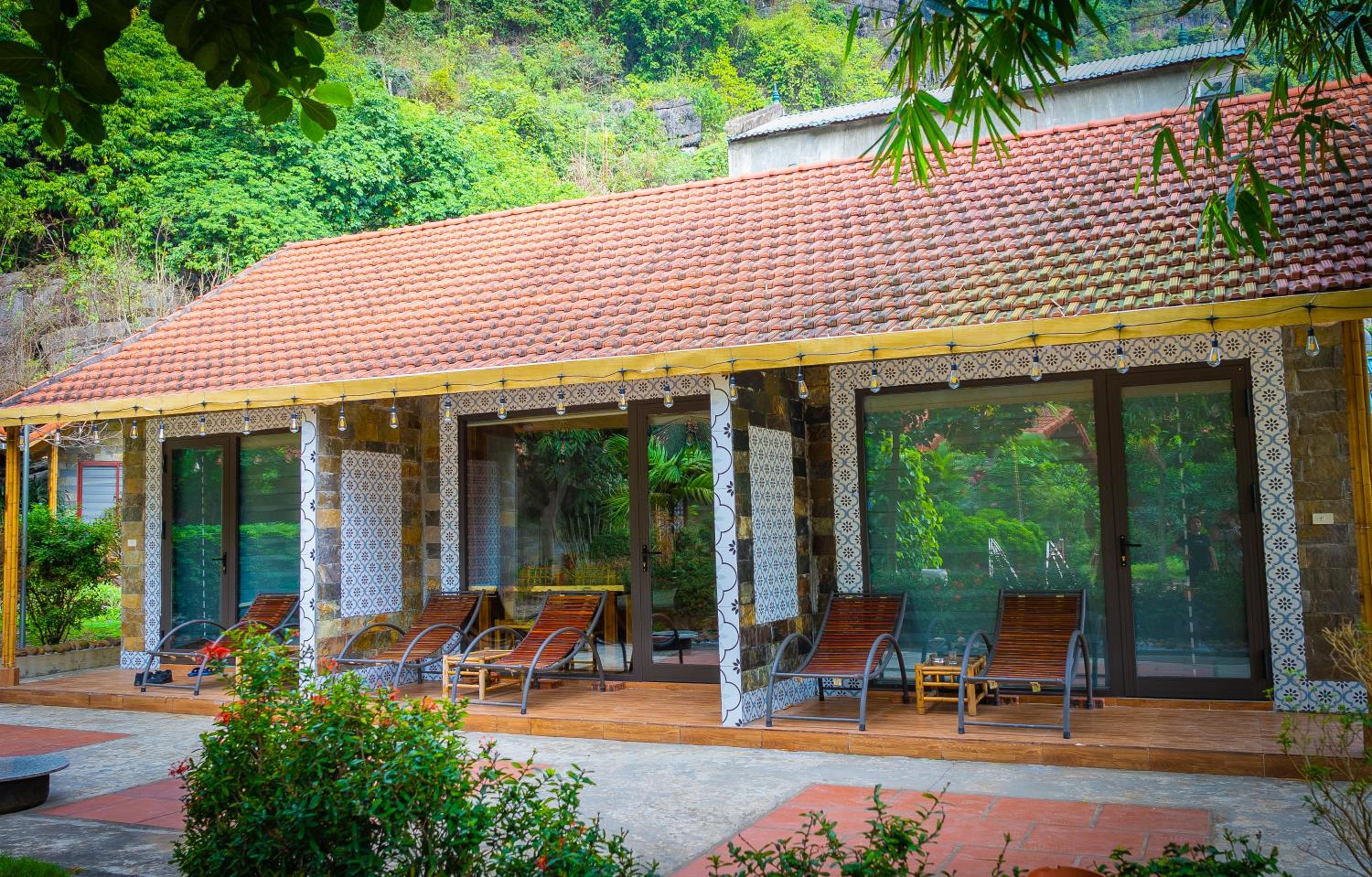
Restez à Tam Coc pour une première visite : les maisons d'hôtes et les petits hôtels sont à distance de marche du quai, de la pagode et des marches de la grotte Mua, et le karst s'élève directement derrière. La plupart des gens consacrent 2 nuits à Ninh Binh sur Stippl. Les maisons d'hôtes ici sont authentiques, avec des repas en famille inclus, et parmi les moins chères du Vietnam ; la ville ne sert que pour l'arrivée et le départ.
Tam Coc
Gîtes familiaux et chambres d'hôtes avec vélos, de 8 € à 30 €, ainsi que quelques hôtels avec piscine au village à partir de 40 €.
Côté Trang An
Les petits resorts et les hébergements chez l'habitant parsèment les rizières, de 25 € à 90 €, sans rien de accessible à pied ; vous avez besoin d'un véhicule.
Ville de Ninh Binh
Hôtels simples et les chambres les moins chères de la province près des gares, de 8 € à 25 €.
Lisière de Cuc Phuong
Quelques lodges et maisons d'hôtes près de la forêt et du centre de primates, €15 à €60, pour les randonneurs.


Que manger à Ninh Binh
Croûte de riz frite profondément en disques dorés, garnie de porc effiloché ou d'un sauté de chèvre, et mangée avec une sauce trempette sucré-salée. Propre plat de Ninh Bình et vendu partout comme souvenir conditionné aussi
Chèvre élevée librement sur le calcaire, donc la viande est plus maigre et ferme qu'une chèvre d'élevage. Servie blanchie au citron vert, grillée aux cinq épices, ou roulée dans du papier de riz avec des herbes
Escargots qui vivent sur les falaises et se nourrissent de plantes médicinales, donnant une texture ferme et croquante contrairement aux escargots de rivière. Saisonnier : avril à août uniquement
Un plat du nord réalisé particulièrement bien ici, anguille frite croustillante ou douce sur des nouilles de verre
Découvrez des adresses gourmandes dans Stippl
Trouvez restaurants et marchés sur la carte, enregistrez-les dans votre itinéraire, fonctionne aussi hors ligne.
Coutumes de Ninh Binh et ce qu'il faut éviter
Donnez un pourboire au rameur
Deux heures de course à la rame à Tam Coc ou Trang An rapportent une petite part du billet ; environ 2 € par bateau à la fin est la norme, plus une boisson au milieu de la rivière.
L'arrêt des broderies est une vente
Les rameurs s'arrêtent couramment au milieu de la rivière pour proposer de l'artisanat ; c'est sans pression et c'est aussi de cette façon qu'ils gagnent, donc un non poli est correct et un petit achat est bienveillant.
Les temples sont des temples en activité
Épaules et genoux couverts à Bái Đính, Bích Động et les temples de Hoa Lư ; Bái Đính est le plus grand complexe bouddhiste du pays et les pèlerins surpassent les visiteurs.
La vallée est faite pour le vélo
C'est plat, c'est ce pour quoi le lieu existe, et les frais de taxi et de scooter sont la ligne cachée d'un budget de Ninh Bình ; les vélos sont gratuits dans la plupart des séjours chez l'habitant.
À faire
- Donnez un pourboire au rameur du bateau, environ 2 € par bateau
- Couvrez les épaules et les genoux à Bái Đính, Bích Động et les temples de Hoa Lư
- Préférez le vélo aux taxis
- Achetez le riz croustillant dans un restaurant plutôt que la version souvenir emballée
À éviter
- Ne vous sentez pas obligé d'acheter la broderie ; un non poli est correct
- Ne faites pas les deux sorties en bateau ; elles sont trop similaires pour justifier la seconde
- Ne montez pas à la grotte Mua au milieu de la journée : pas d'ombre, cinq cents marches et trente degrés à partir de mai
- Ne buvez pas l'eau du robinet
Combien coûte un voyage à Ninh Binh
Budget
17–22 €
Séjour chez l'habitant ou maison d'hôtes, restaurants locaux, vélo loué, une sortie en bateau.
Intermédiaire
34–50 €
Bungalow avec piscine, repas au restaurant, les deux sorties en bateau et un guide.
Confortable
80+ €
Resort dans les rizières, chauffeur privé, vélo avec guide.
Suivez ce que vous dépensez vraiment
Définissez un budget journalier par pays et enregistrez vos dépenses dans n'importe quelle devise pendant le voyage.
Anecdotes sur Ninh Binh
Les rameurs font la course en aviron avec leurs pieds. Ils sont assis face à l'avant avec les rames croisées contre les plats-bords, ce qui libère leurs mains et fonctionne dans les sections de grottes basses où un coup normal ne passe pas.
Hoa Lu a été la capitale du Vietnam pendant seulement 42 ans. Elle a été choisie en 968 parce que les tours calcaires forment un anneau défensif, et abandonnée en 1010 quand la cour s'est déplacée vers ce qui est maintenant Hanoi.
Trang An est l'un des rares sites du patrimoine mondial mixtes d'Asie du Sud-Est. L'UNESCO l'a inscrit pour son paysage et son archéologie ensemble, ce que moins de quarante sites dans le monde peuvent revendiquer.
L'ensemble du village Kong: Skull Island a été largement supprimé. Trang An continue de capitaliser sur le film de 2017, mais ce qui subsiste, c'est le paysage qui a été filmé, pas les décors.
Les escargots des montagnes se nourrissent de plantes médicinales sur les falaises. Cela est attribué à leur texture ferme, et ils ne sont au menu que d'avril à août.
Ninh Binh a grandi dans la réforme provinciale de 2025 plutôt que de disparaître. Elle a absorbé Ha Nam et Nam Dinh et conservé son propre nom, tandis que Hoi An a perdu Quang Nam au profit de Da Nang.
Conseils locaux pour Ninh Binh
Louez un vélo
Routes plates, peu de circulation et tous les sites à moins de douze kilomètres. La plupart des maisons d'hôtes les prêtent gratuitement, et la boucle Bich Dong, grotte Mua, Trang An et Hoa Lu est une journée.
Restez, ne faites pas d'excursion d'une journée
À deux heures de Hanoi et vendus comme excursion d'une journée partout, et les excursions d'une journée atteignent les bateaux à l'heure la plus chargée. Une nuit à Tam Coc vous offre les rizières à l'aube et des grottes vides.
La gare n'est pas à Tam Coc
La gare de Ninh Binh est à huit kilomètres des maisons d'hôtes de Tam Coc ; un taxi coûte environ 5 € et les maisons d'hôtes viennent chercher si on le leur demande. Les bus en provenance de Hanoi déposent plus près.
Combien de temps rester
La plupart des gens passent 2 nuits à Ninh Binh sur Stippl, ce qui est la boucle en vélo, un bateau et la grotte Mua en fin de journée. Le troisième est Cuc Phuong ou Van Long.
Les marches de Mua Cave sont le danger
Inégales, raides, sans garde-fous par endroits et glissantes après la pluie, et les gens les descendent dans l'obscurité après le coucher du soleil. Lampe frontale, et commencez à descendre avant que la lumière ne disparaisse.
Routes non éclairées après la tombée de la nuit
Les scooters sont plus pratiques ici qu'en ville et les sites sont espacés de huit à douze kilomètres, mais le retour depuis un point de vue sur le coucher de soleil se fait sur des routes non éclairées. Faites-le en plein jour.
Questions sur Ninh Binh, réponses
En tant qu'étape entre Hanoi et le centre, deux heures au sud en train ou en bus, plutôt que comme une excursion d'une journée. Organisez le nord avec Stippl et prévoyez deux nuits ; le bateau, l'escalade de la grotte et le vélo demandent chacun une demi-journée. Montrez l'itinéraire à ceux qui l'ont déjà fait, sur des subreddits comme r/VietnamTravel.
Deux. La plupart des gens passent 2 nuits à Ninh Binh sur Stippl et seulement 20,6 % des étapes ne durent qu'une nuit, donc la version excursion d'une journée vendue dans chaque auberge de Hanoi est un choix minoritaire. Deux nuits, c'est une journée en bateau, la grotte Mua et la boucle à vélo le lendemain.
Près de la moitié : 46,7 % des voyages au Vietnam planifiés sur Stippl incluent une étape à Ninh Binh, et avec environ 56 000+ étapes planifiées, cela est devenu une partie standard d'un itinéraire du nord plutôt que le détour que décrivaient les anciens guides. C'est au milieu d'un voyage, pas à l'une ou l'autre extrémité.
L'un ou l'autre, pas les deux ; ils sont trop similaires pour justifier le deuxième. Tam Coc propose des rizières et trois tunnels de grottes, Trang An propose des grottes et des temples avec trois choix d'itinéraires. Donnez un pourboire au rameur, environ 2 € par bateau, et attendez-vous à l'arrêt des broderies au milieu de la rivière, qui est une vente sans pression et un non poli est correct.
Deux fois : de fin mai à début juin, et à nouveau de fin septembre à début novembre, et celui d'automne est plus calme. Janvier et février sont secs mais gris avec une ou deux heures de soleil par jour et des crachinements persistants ; novembre et décembre sont secs et clairs, ce qui est la combinaison sur laquelle les photographies ont été prises.
Effectivement oui. Les sites sont à sept à douze kilomètres de distance sans transport public, la vallée est plate et les séjours chez l'habitant prêtent des vélos gratuitement. Les voyageurs planifient Ninh Binh 63 jours à l'avance sur Stippl, il y a donc le temps de réserver un séjour chez l'habitant avec des vélos ; la grotte Mua compte environ cinq cents marches sans ombre, montez-y tôt.
Chaque guide est écrit par la rédaction Stippl et vérifié avec les voyages que nos voyageurs planifient réellement. Vous avez repéré une information dépassée ? Dites-le-nous.

Planifiez Ninh Binh dans Stippl
Planification jour par jour, hébergements et budget dans une seule application, avec chaque lieu de ce guide déjà sur la carte.
Télécharger l'application